Weird weather terms describe unusual, extreme, or counterintuitive atmospheric phenomena. Due to their strange or mysterious terminology, these terms capture public attention and bring greater interest in weather research. By demystifying these terms, we can learn more about interpreting climate change and forecasting risks. This article will explore a number of unique phenomena, including their significance and implications for the public.
Nor’easters
Nor’easters are large-scale storms that are common along the Atlantic coast of North America from fall through spring. The name derives from the fact that nor’easters are created by strong northeasterly wind gusts blowing from the Atlantic Ocean, bringing heavy rain, snow, and flooding.
These storms are unique because they thrive on the cold air of the eastern United States rather than warm air like tropical cyclones. Generally, warmer air has more energy, but nor’easters still manage to create blizzards and other extreme weather. The prime nor’easter season is between September and April. The term itself has been used since the mid-19th century and is likely a literary affectation meant to capture the unique New England accent.

Atmospheric Rivers
When it comes to weird weather words, little could be more confusing than invisible rivers in the sky. According to the National Oceanic and Atmospheric Administration (NOAA), atmospheric rivers are bands of water droplets drawn through the sky by jet streams. These massive circulation systems pull water around the world, carrying dust particles from the Sahara desert to Northern Africa or even further, to Europe.
Generally, they will move from the tropics to higher latitudes. Rather than having fixed boundaries, they are steered by low and high-pressure systems, which determine wind speed and direction.
These rivers are crucial for the global water cycle, but they can also cause flash floods and other severe weather. One such example is the California floods in 2023. When atmospheric rivers interconnect with other powerful atmospheric forces, like the polar vortex, they can lead to large winter storms.
Supercell Thundersnow
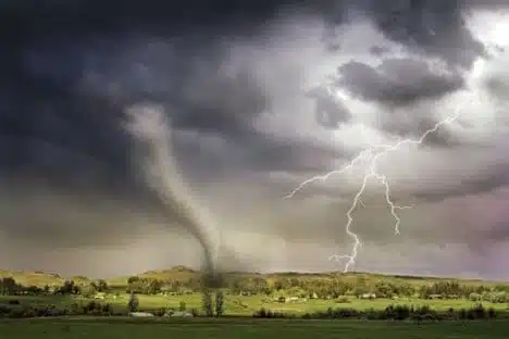
People generally expect snowfall to be quiet and peaceful, but sometimes, it is accompanied by lightning, thunder, and even tornadoes. This brings us to supercell thundersnow, a shocking phenomenon that confuses meteorologists and the public.
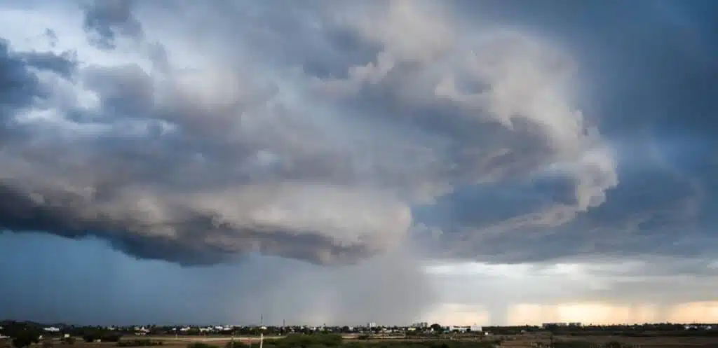
A supercell thunderstorm is a persistent, violently rotating column called a mesocyclone. The leading edge of the thunderstorm will show up as a menacing shelf cloud with flashes of lightning. In some instances, this can spawn funnel clouds, the precursor to a tornado. The straight winds that spawn from the supercell can cause serious damage to homes and power lines. They are most frequently seen in the Great Plains states, such as Kansas, Nebraska, and South Dakota.
Most of the time, rain falls due to a supercell thunderstorm, which typically spawns during the summer. Sometimes, soft hail occurs, as water vapor drawn down from the atmosphere condenses into ice crystals.
However, if a supercell thunderstorm occurs in frigid temperatures, it may actually lead to a snowstorm. This happened during the 2011 Groundhog Day Blizzard, which hit the Great Lakes region from February 1 to February 2nd.

Pineapple Express
While the Pineapple Express may now be more closely associated with a popular movie, the term originates from the atmospheric river of the same name. This is part of the global atmospheric air “conveyor belt,” moving humid air from the tropics up to higher latitudes.
The Pineapple Express starts in Hawaii and is so named because of the state’s large pineapple farms. From its origins, it moves up toward the Pacific Northwest, creating the area’s dense fog and temperate rainforests. While the Pineapple Express is a crucial element of the area’s climate, it can also bring up to five inches of rain in a single day.
This atmospheric river interacts with local geography, like the Sierra Nevadas, to create extreme weather events. For example, when the Pineapple Express is heavily laden with water and hits the mountains, it is forced up, where the water vapor condenses into ice pellets. This causes extreme snowfall that can leave people stranded in the mountains or damage homes.

Bomb Cyclones
The term “bomb cyclone” was first used in the 1980s to refer to explosive cyclogenesis, also known as bombogenesis. This happens when a storm’s barometric pressure plummets more than 24 millibars in less than 24 hours.
These low-pressure systems happen when there is a strong air temperature gradient between warm and cold masses. Such storms will pick up heat energy from warm ocean currents, like the Gulf Stream, and are nurtured by strong wind speeds from jet streams.
It is important to note that these are not tropical storms or hurricanes, as they occur due to temperature differentials. They don’t have the same shape or take the same path.
These rapidly intensifying storms are extremely dangerous and can cause extensive property damage, as seen by the January 2018 bomb cyclone that hit the East Coast of the United States. Nor’easters are sometimes classified as winter bomb cyclones.
The dramatic terminology provides a sense of danger and highlights how quickly these storms intensify, forcing people to take them seriously.

Chinook Winds
Named after the Chinook Native American tribe, Chinook winds are a bizarre phenomenon that can lead to flash droughts and extreme surface temperatures. This phenomenon occurs on the eastern (lee) side of the Rockies due to a combination of topography and meteorology.
Warm, dense air from the Pacific blows against the windward (west) side of the Rockies, where it experiences orographic lift. This is when a strong wind hits a mountain and is forced upwards. As it rises higher in the atmosphere, it expands and loses its ability to hold moisture, creating clouds and rain.
What goes up must come down, so the wind begins to descend on the other side of the mountain, expanding again as it goes. However, it has lost most of its humidity and is just hot air. This sudden descent can raise the ground temperature by 20-40°F in only a few hours.
The Chinook winds are an example of what is globally known as a Foehn wind or rain shadow wind. Other places that experience Foehn winds include the Alps in Europe, the Zagros Mountains in the Middle East, and the “Three Furnaces” cities in China.
Because of Chinook winds, the relative humidity can be drastically different on opposite sides of the Rockies, disrupting local ecosystems and human activities. The sudden loss of moisture may damage plants, while those working outdoors must be careful to avoid heat stroke or other health conditions.

Conclusion
While meteorology is full of unusual terms, these stand out as some of the most dramatic and distinctive. Weird weather terms are not just curiosities, though; they help the public connect with climate events and help them better understand atmospheric extremes. Because they are so memorable and unique, people are more likely to retain information about these events, which can keep them safe during storms.
FAQs About Weird Weather Terms
What are weird weather terms?
These are terms that meteorologists have created to describe specific events in a colorful and memorable way. One example is “frost quake,” which refers to minor seismic activity caused by saturated frozen soil.
Why do meteorologists use terms like “Pineapple Express” or “Bomb Cyclone”?
Meteorologists use these terms because they are easy for people to remember, making them more likely to pay attention.
In addition to being a colorful term, “Pineapple Express” accurately explains that this particular atmospheric river originates in Hawaii and draws water toward the West Coast. Meanwhile, “bomb cyclone” shows that these storms expand rapidly and have unpredictable effects, which helps to emphasize how dangerous they are.
Are weird weather events becoming more common due to climate change?
Yes, unusual events are becoming more common because of climate change. Heatwaves, droughts, floods, tornadoes, wildfires, and hurricanes are all increasing in frequency and intensity. In some cases, the extreme events are happening outside of their expected ranges or seasons, such as wildfires occurring in the winter or tornadoes spawning in typically safe places.
Climate scientists are still working to uncover the links between certain events and climate change to keep people safe. However, some types of weather will not move, though they may change in frequency or strength. For example, the Chinook winds are caused by the Rocky Mountains, a topographic feature.
Can weird weather terms be misleading?
These terms can be misleading if they are used incorrectly or are not contextualized for the audience. One common example is people claiming that any sudden cold snap is due to the polar vortex. However, this refers to the circulation of strong winds in the stratosphere, which can be pushed down into lower latitudes by a weakened jet stream.
It’s important to use these terms correctly so that people understand what they mean and take the appropriate precautions when extreme events occur. As an example, calling a weak storm a “bomb cyclone” may mean that the next time meteorologists warn that a storm is rapidly intensifying, people won’t take it seriously because they remember that last time it wasn’t so bad.

