

The Beaufort Wind Scale
The Beaufort Wind Scale measures wind speed on land and sea, observing the effects of the natural flow of wind in any direction in the atmosphere. It’s named after British Admiral Sir Francis Beaufort.
This scale, which was first used in the early 19th century, was originally designed for maritime use, as it clearly explains what sailors could expect from different wind conditions. However, it is now frequently used in weather reporting and outdoor forecasting.
The Beaufort Wind Scale utilizes 12 stages that represent the evolution from a light breeze to major hurricanes or tropical cyclones. For each stage, the table includes the wind speed in miles per hour, kilometers per hour, and knots, which is a nautical wind speed measurement.
As wind speed varies per second, the Beaufort Scale is only the wind’s mean speed, not a precise measurement. All speed measurements should be taken from a standard 10 meters above the ground.
The National Oceanic and Atmospheric Administration has provided the original text of the Beaufort Wind Force Scale. We will include this, as well as a simpler, modern explanation of its meaning.
Force 0 – Calm (0-1 mph or 0-1.5 km/h or 0-1 knots). – “Sea like a mirror. Calm; smoke rises vertically.”
In general, it’s rare to see a completely calm day where smoke rises straight up. For sailors of Beaufort’s era, this would have been a bad thing, as larger ships could not have moved without at least a light breeze.
Force 1 – Light Air (1-3 mph or 1.5-5 km/h or 1-3 knots) – “Ripples with the appearance of scales are formed, but without foam crests. Direction of wind shown by smoke drift, but not by wind vanes.”
At Force 1, the wind is so light that windsocks will not move, and there will only be slight ripples on the water’s surface. It still would not be possible for sailing ships to move.
Force 2 – Light breeze (4–7 mph or 6–11 km/h or 4-6 knots) – “Small wavelets, still short, but more pronounced. Crests have a glassy appearance and do not break. Wind felt on face; leaves rustle; ordinary vanes moved by wind.”
At this point, wind vanes will start moving. On water, wave crests will not show foam and will not topple over themselves, a process called breaking.
Force 3 – Gentle breeze (8–12 mph or 12–19 km/h or 7-10 knots) – “Large wavelets. Crests begin to break. Foam of glassy appearance. Perhaps scattered white horses. Leaves and small twigs in constant motion; wind extends light flag.”
“White horses” means waves that have foamy white crests because of the wind breaking on them. “Scattered white horses” means only a few waves will have foamy crests.
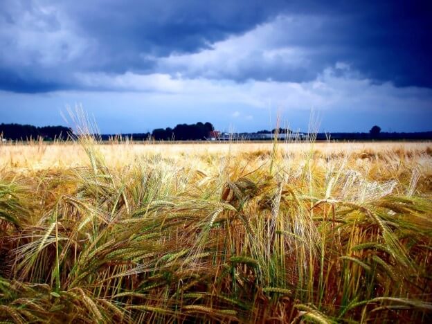
Force 4 – Moderate Winds (20-29 km/h or 13-18 mph or 11-16 knots) – “Small waves, becoming larger; fairly frequent white horses. Raises dust and loose paper; small branches are moved.”
“Fairly frequent white horses” means most waves have that foamy, white appearance, but they are still small.
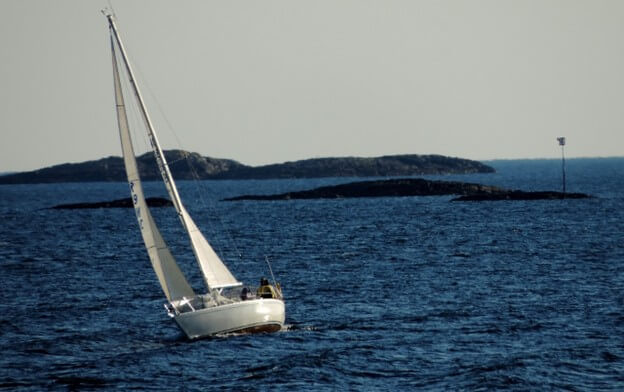
Force 5 – Fresh Breeze (19–24 mph or 30-39 km/h or 17-21 knots) – “Moderate waves, taking a more pronounced long form; many white horses are formed. Small trees in leaf begin to sway; crested wavelets form on inland waters.”
At this point, the breeze can be clearly felt, and the waves are moving smoothly but not dangerously. Small wavelets may be present in lakes and rivers near the shore.
Force 6 – Strong breeze (40–50 km/h or 25–31 mph or 22-27 knots) – “Large waves begin to form; the white foam crests are more extensive everywhere. Large branches in motion; whistling heard in telegraph wires; umbrellas used with difficulty.”
At this point, the water condition can become dangerous for smaller crafts, as larger waves could swamp their boats. On land, people will struggle to use umbrellas, and the wind may blow things over.
Force 7 – Near Gale (32-38 mph or 51-61 km/h or 28-33 knots) – “Sea heaps up and white foam from breaking waves begins to be blown in streaks along the direction of the wind. Whole trees in motion; inconvenience felt when walking against the wind.”
The water is very foamy, and you may be hit by sea spray from the wind.
Force 8 – Gale (62-74 km/h or 39-46 mph or 34-40 knots) – “Moderately high waves of greater length; edges of crests begin to break into spindrift. The foam is blown in well-marked streaks along the direction of the wind. Breaks twigs off trees; generally impedes progress.”
We have reached a “gale sea.” A gale sea heaps water high and leads to deep wave crests, which can pose major dangers to smaller craft.
Force 9 – Strong Gale (47–54 mph or 75–87 km/h or 41-47 knots) – “High waves. Dense streaks of foam along the direction of the wind. Crests of waves begin to topple, tumble, and roll over. Spray may affect visibility. Slight structural damage occurs (chimney-pots and slates removed).”
Medium-sized ships may now be in danger as the waves topple and visibility becomes low. Minor structural damage may also occur.
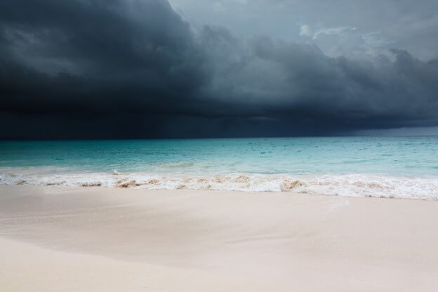
Force 10 – Storm (55-63 mph or 88-101 km/h or 48-55 knots). – “Very high waves with long overhanging crests. The resulting foam, in great patches, is blown in dense white streaks along the direction of the wind. On the whole, the surface of the sea takes on a white appearance. The tumbling of the sea becomes heavy and shock-like. Visibility affected. Seldom experienced inland; trees uprooted; considerable structural damage occurs.”
At this point, the sea is dangerous for crafts of nearly any size, and there may be effects far inland, too.
Force 11 – Violent Storm (64-72 mph or 102-117 km/h or 56-63 knots) – “Exceptionally high waves (small and medium-size ships might be for a time lost to view behind the waves). The sea is completely covered with long white patches of foam lying along the direction of the wind. Everywhere the edges of the wave crests are blown into froth. Visibility affected.”
There may be low visibility, and the waves may engulf smaller ships.
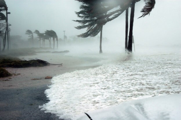
Force 12 – Hurricane (73mph or 118km/h or 64-71 knots) – “Very rarely experienced; accompanied by wide-spread damage. The air is filled with foam and spray. Sea completely white with driving spray; visibility very seriously affected.”
At this point, winds have reached hurricane levels, where ships may sustain severe damage or even sink.
Saffir-Simpson Hurricane Wind Scale
The Beaufort Scale is helpful for understanding the impacts of wind on human lives and property. However, it only goes up to 73 mph. To better understand hurricanes, we need to turn to the Saffir-Simpson scale, developed in 1971 by meteorologist Dr. Robert Simpson and engineer Herbert Saffir. Its purpose is to communicate hurricane strength and possible damage to protect human lives and property.
The Saffir-Simpson Scale is divided into five categories based on wind speed. It is important to note that the scale does not consider storm surges, which are dangerous ocean conditions that can cause widespread flooding.
Category One: 74-95 mph (119-153 km/h or 64-82 knots)
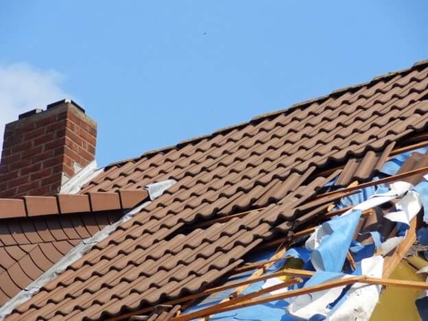
These very dangerous winds will produce some damage, including to siding, gutters, roofs, shingles, and frame structures. Some trees may fall. There may be damage to power lines and subsequent power outages.
One notable Category One hurricane was Hurricane Debby in August 2024, which became the costliest natural disaster in the history of Canada’s Quebec province.
Category Two: 96-110 mph (154-177 km/h or 83-95 knots)
Even well-built homes could sustain major roof damage, and there will likely be many trees and power poles downed from the winds. There will be long-lasting power outages. Hurricane Dolly, which hit Guatemala and Mexico in 2008, was one of the deadliest and most expensive Category Two hurricanes, killing 26 people.
Category Three: 111–129 mph (178–208 km/h or 96–112 knots)
There will be extensive damage to trees and homes. Even sturdy homes may incur major damage, such as losing their roofs or gables. Many trees will be uprooted, and major highways may be blocked. Electricity and water could be unavailable for days or weeks.
One well-known Category Three hurricane is Hurricane Sandy, which hit the East Coast of the United States in 2012 and caused over $68 billion in damages.
Category Four: 130–156 mph (209–251 km/h or 113–136 knots)
Sturdy homes may lose some external walls or the majority of their roof structures. Most trees will have been uprooted. Because most power lines will have been destroyed, the area may be uninhabitable for weeks or months after the storm passes.
Notable Category Four hurricanes include Hurricane Helene in 2024, which led to massive flooding across North Carolina and Tennessee, and Hurricane Ida in 2021.
In the western North Pacific, a tropical cyclone with sustained winds above 150 mph is called a “super typhoon.”
Category Five: 157 mph or more (252 km/h or more, or 137 knots or more)
The majority of framed structures in the area will be destroyed due to total roof failure and wall collapse. Downed trees and fallen power poles will isolate residential areas and may make it difficult to rescue survivors. Power outages could last months, and the area will be uninhabitable for a significant period.
Two well-known Category Five hurricanes include Hurricane Milton in 2024 and Hurricane Irma in 2017.
Comparing the Two Wind Scales
While both these scales measure wind, they focus on different sections of the long and complex evolution from still wind to a major hurricane. The Beaufort Wind Scale is a general-purpose system that can be used across many contexts, such as outdoor sports, sailing, or general weather conditions. Meanwhile, the Saffir-Simpson scale only looks at hurricane-force winds, especially their impact on infrastructure.
Force 12 on the Beaufort Scale roughly aligns with the lower range of a Category One hurricane, where the Saffir-Simpson Scale can then assess the potential damage in greater depth. The two scales complement each other and have different uses depending on wind speed.
Summary
Both the Beaufort Wind Scale and the Saffir-Simpson Hurricane Wind Scale are invaluable tools for assessing wind speeds and analyzing storm intensity. The Beaufort Wind Scale is for a broad application for everyday wind speeds, while the Saffir-Simpson Hurricane Wind Scale assesses hurricane-force wind risks.
Together, these tools help everyday people and scientists analyze potential dangers and protect themselves. If you want to know even more about weather tools, consider exploring our repository of blog posts that share more in-depth knowledge about weather and climate.